Heitersheim in the Black Forest

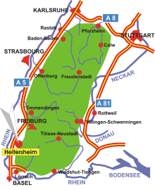
Map: Black Forest
Information in brief
- Location: at the western edge of the Black Forest, 20 km south of Freiburg
- A 5 exit at Hartheim/ Heitersheim (No. 64b)
- 254 m above sea level
- 6.100 inhabitants
- District: Gallenweiler
Description
Heitersheim is located between the Upper Rhine Plain in the west and the foothills of the Black Forest in the east.


