


Pfalzgrafenweiler in the Black Forest
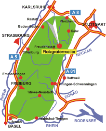
Map: Black Forest
Information in brief
- Location: in the Northern Black Forest, 15 km north-east of Freudenstadt
- Autobahn A 81 exit at Rottenburg (No. 29) or Horb (No. 30)
- 600-750 m above sea level
- 7.200 inhabitants
- Districts: Kälberbronn, Edelweiler, Herzogsweiler, Bösingen, Durrweiler, Neu-Nuifra
Description
Pfalzgrafenweiler is located on the high plateau of the Northern Black Forest.
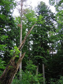
Photo: The avalanche forest near Kälberbronn
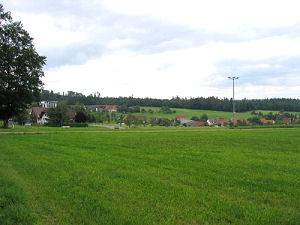
Photo: Kälberbronn