


Nagold in the Black Forest
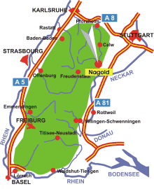
Map: Nagold in the Black Forest
Information in brief
- Location: in the Northern Black Forest, 25 km south of Calw
- 400-600 m above sea level
- 21.700 inhabitants
- Districts: Emmingen, Gündringen, Hochdorf, Iselshausen, Mindersbach, Pfrondorf, Schietingen, Vollmaringen
Description
Nagold is located at the eastern edge Black Forest in a valley widening where the Waldach flows into the river Nagold. The old town with its convivial pedestrian precinct is located on the right-hand bank, and the Schlossberg (castle hill) with the ruins of Castle Hohennagold is on the opposite bank.
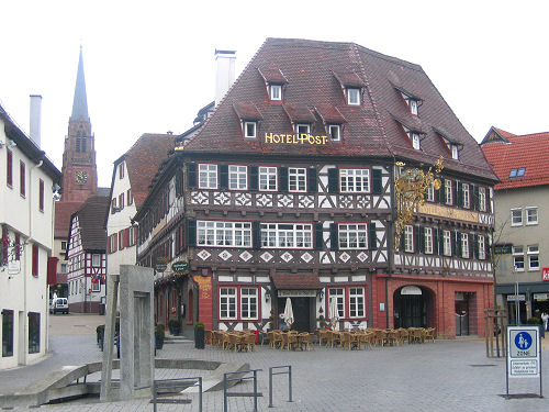
Photo: Pedestrian area