Laufenburg am Rhein

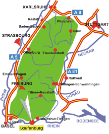
Map: Black Forest
Information in brief
- Location: 15 km west of Waldshut-Tiengen
- 330-715 m above sea level
- 8.800 inhabitants
- Districts: Binzgen, Grunholz, Hauenstein, Hochsal, Luttingen, Rhina, Rotzel, Stadenhausen
Description
Laufenburg is located on both sides of the High Rhine, one part belongs to Germany, the other part to Switzerland.


